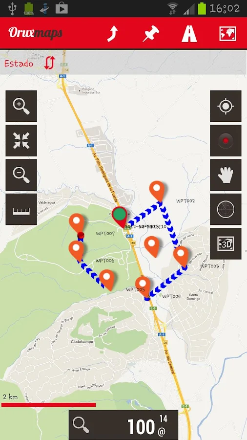
Description: Map viewer, track logger.
You can use OruxMaps for your outdoor activities (running, treking, mountain bike, paragliding, flying, nautic sports,....)
100% free
100% no adversisements
100% no adversisements
Online and offline maps. Support to multiple formats:
-OruxMaps format. You can use maps from Ozi Explorer transformed wit a PC tool.
-.ozf2
-.img garmin (vectorial) -no full support is provided-.
-.mbtiles
-.rmap
-.map (vectorial from mapsforge). Support to custom themes similat than Locus themes.
Support to Wms, you can use the application as a WMS viewer.
3D view.
Support to multiple external devices:
-GPS bluetooth.
-Heart rate monitors, bluetooth Zephyr, Polar (including bluettoh smart devices, like polar H7).
-ANT+ (speed, cadence, heart rate, distance,...).
-AIS information systems (experimental), for nautical sports, using Wifi o BT.
More features:
Support to KML KMZ and GPX formats.
Share your position with your friends, display the position of your friends in your device.
Download online maps for offline use.
Text to speech support.
Profiles; save your preferences in your SD card.
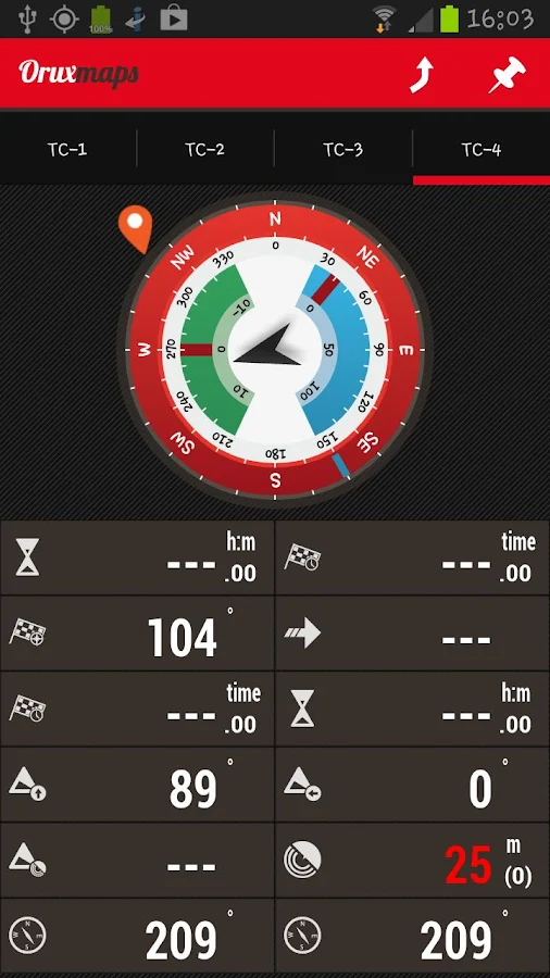
Statistics with graphics.
Follow routes, with different alarms to alert you if you are near a waypoint, or you are far from the route.
Create/save wayponits, attaching photo/audio/video extensions.
Custom waypoints types, with your icons.
Basic support to Geocaching.
Correct the altitude of your tracks/routes using DEM files (offline) or online services.
Search/download tracks from:
-everytrail.com
-gpsies.com
Search or create tracks using online services from Cloudmade or offline using Broute app.
-everytrail.com
-gpsies.com
Search or create tracks using online services from Cloudmade or offline using Broute app.
Upload tracks to:
-mapmytracks.com
-trainingstagebuch.org
-ikimap
-wikirutas
-openxplora
-mapmytracks.com
-trainingstagebuch.org
-ikimap
-wikirutas
-openxplora
Live tracking using:
-mapmytracks.com
-okmap application
-gpsgate protocol
-mapmytracks.com
-okmap application
-gpsgate protocol
Android OS Requierements: 4.0+
Screenshots:
More info: